Ken's Journal Valdez, Alaska |
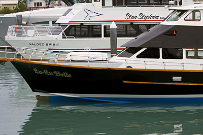
Here's the boat we cruised on - the Lu-Lu Belle. The boat is not large and holds perhaps 40 passengers. The boat is captained by the owner. While underway, he maintains a running commentary on the history, geology, culture, economics and animals of the area. You can ride with the captain in the wheel-house if you desire. In the background is one of the boats used by the Stan Stephens Tour Company. Their boats have double the capacity of the Lu-Lu Belle and are company run. Given the cost is the same, I prefer the more intimate approach of the Lu-Lu Belle. |
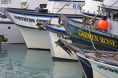
A line-up of some of the commercial fishing vessels in the Small Boat Harbor. |
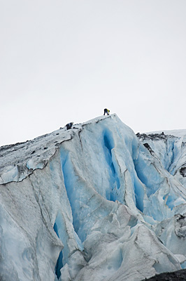
The day after our boat tour, we drove back out the Richardson Highway, over Thompson Pass to the Worthington Glacier. It's an easy hike to the face of the glacer - but today, like many I've seen on this trip, it was raining. Look carefully just right of center and you can see a group of people. That's a bunch of kids getting ready to scale the face of the glacier. This is a sort of "outward bound" thing for them - and none of 'em has done anything like this before! |
Their two guides on the top edge rigging the belay for the ropes the kids will use. |
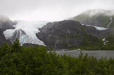
Back near the parking lot, a view of the two finger of the glacier and the glacial lake between the glacier and the terminal moraine. The finger on the left is the one pictured above. |
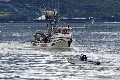
Back at Valdez, this is the view out the windshield of the RV. A local fisherman, a commercial seiner and far in the background, a tanker taking on a load at the terminus of the Alaska Pipeline. |
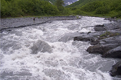
The next day, still overcast but not actually raining, we decided to take another hike - this one the Mineral Creek Trail at the west edge of Valdez. Of course, this is the Mineral Creek - at an unnamed chute, flume or channel. This is a wide, wild creek fed by several glaciers in the area. The gray color of the water comes from "Glacial Flour," stone ground up into a powder like consistency by the movement of the glaciers. If you look carefully just left and up from the center, you'll see Lesley standing on the shore of the creek - now you've some perspective of the size and the amount of water. |
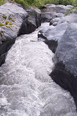
Now, I turn around 180º and take a shot of the flume - this is only about 4 feet wide and ALL the water flows through this channel. It's got to be 20-30 feet deep to handle all this water! |
Shot from a little further downstream - the 2x8 I was standing on to take the previous shots! Don't try this if you're subject to vertigo! |
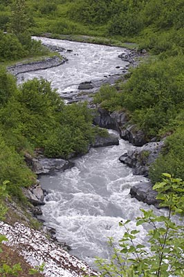
Back on the main trail, downstream slightly, a shot of the creek and the channel. |
Although it was early July, there was still a lot of snow along the trail. Here's a shot of two avalanches across the creek that had not yet melted. The creek tunnels under 'em. The one in the foreground we had to cross - not across the creek itself, but the snow on the right covered the trail to a depth of some 16 feet - so we had to climb over it. |
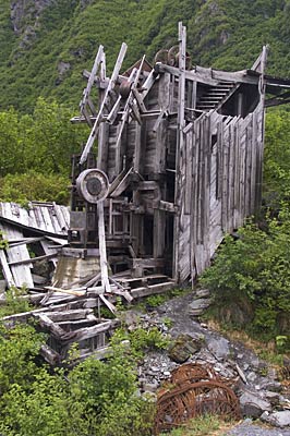
The point of the whole trail - an abandoned gold mine. This was the end of several tram-lines that brought the ore from several mineshafts to a central location for processing. If you search the area, you can find other hardware and debris from the operation, but this is the most apparent. We walked upstream a little from this and found four guys panning for gold in a side-stream. I asked if they were having any luck - and got an evasive answer - there is still gold in these hills!! |
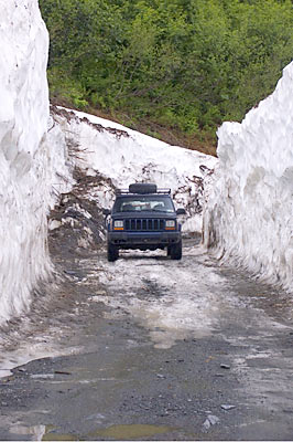
Getting to the trailhead had it's interesting points too. Here we're in the middle of another avalanche not yet melted - a snow plow had cut a path through what was left. |
- Next - |
Page 12 |
