Ken's Journal Kennicott, McCarthy, the Wrangells & the Root Glacier |
| We left Valdez on July 4th hoping for better weather once we got over the mountains. We were headed to Kenny Lake, would camp there for the night and make our way to McCarthy and Kennicott. Kenny Lake is only a couple hours from Valdez, so once we were set up we decided to make the trip to McCarthy and Kennicott the same day. In retrospect, we should have taken another day as there's so much to see. Also, from Kenny Lake to McCarthy is some 80 miles one-way and only 20 of that is paved. The road dead-ends at McCarthy and you have to hike or take a bus service the remaining 5 miles to Kennicott. McCarthy and Kennicott are both in the Wrangell-St Elias National Park. I'm not sure what the exact arrangements are, but there are still private holdings in McCarthy, Kennicott and some other areas of the Park. Kennicott, the site of the abandoned Kennecott Mining operation, has a hotel and a few summer homes. McCarthy has been taken over by a modern day Birkenstock crowd - if you didn't know different, you'd think you were in a hippy commune in the 60's - all serving the hiker, back-packer, mountain and ice climber. |
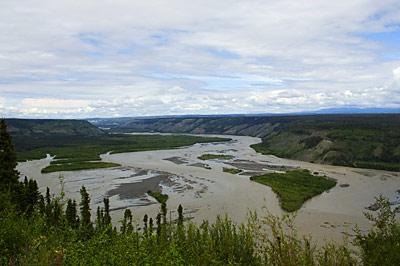
This is the Copper River taken from an overlook on the Edgerton Highway. Vistas like this are common in Alaska - drive carefully and keep your eyes on the road!
|
It would have been nice if the rails had be reprocessed and served some useful purpose, but unfortunately, the earthquake and subsequent tsunami of 1964 intervened, wiping out Valdez and leaving the scrap rails on the floor of the ocean. |
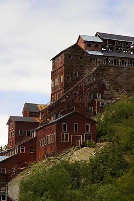
The old Kennecott mine. Kennicott is the town and Kennecott is the mine - the misspelling the result of a clerical error. |
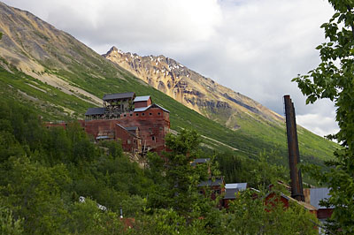
Another shot, a different angle. The stacks to the right are from the power plant. Most of these operations were powered by electric. |
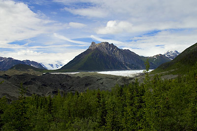
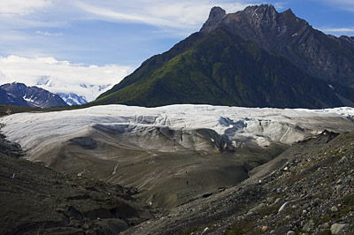
We decided on a hike to the Root Glacier - only about 1.5 miles one-way. Quite a hike though! The white in the center of the picture is the Root Glacier. The peak is Donoho Peak. Behind Donoho is the Kennicott Glacier. The Root joins the Kennicott just this side of Donoho Peak. |
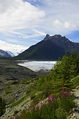
A closer shot. In front of the glacier is the moraine field - as a glacier scrapes through a valley, it pushes all the debris in front of it. If the debris field is large enough, it comes up over the glacier and the glacier tunnels underneath. |
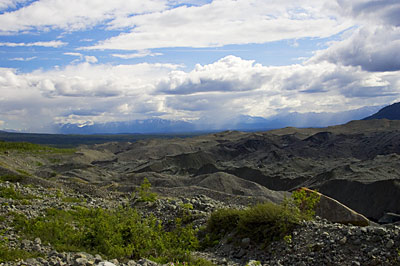
I turn around and below the glacier is the vast moraine field left as the Glacier retreats. This field is some three miles wide by six miles long by several hundred feet deep. And there's still a substantial quantity of ice under the debris making it just a bit dangerous to hike on as it occasionally collapses as it slowly melts. |
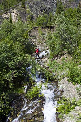
A fellow hiker crossing a stream just ahead of us. |
Up close to the Root Glacier. This'll give you a perspective on the size of the nature we're dealing with. Look carefully halfway between the center of the picture and the bottom and you'll see two hikers. |
Can't find 'em? Ok. Here's an enlargement for you. We're on our way there. See the next Journal!! |
Next, More Glacier |
Page 13 |
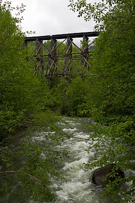 An abandoned railroad trestle over Gilahina Creek. The road to McCarthy is the roadbed of the railroad that served the copper mine at Kennicott. Once the mining operation was abandoned, the railroad was abandoned as well. The rails were stripped from the line and carried to Valdez in anticipation of shipping them to the lower 48 to be reprocessed as scrap steel. The ties were thrown off the roadbed and the road to McCarthy was born. Local legend has it that the occasional railroad spike surfaces and lays in wait for the unwary - puncturing a tire. We saw none, but we did see the occasional railroad tie buried in the road. I believe the legend is perpetrated by the company that will charge you $80 one-way for a ride into McCarthy.