Ken's Journal Capitol Reef National Park - Torrey, Utah - 07/17 - 07/21/2004 |
|||
|
|||
Capitol Reef is bounded by the Glen Canyon National Recreation Area, the Grand Staircase-Escalante National Monument, the Dixie National Forest, the Fishlake National Forest, and parts of the Manti-La Sal National Forest. Confusing? You betcha. Add to all that the land the BLM is managing and it's hard to figure out who manages the square footage you happen to be on at the time. There is access to all this land and you can find this access if you have a variety of maps available to you and are willing to risk a little in going off the maintained road system. From Boulder, Utah (not Colorado), some 37 miles south of Torrey on SR12 is the beginning of what's called the 'Burr Trail'. The Burr Trail is 38 miles long and is for the most part, a well maintained paved scenic byway. Don't let that fool you though. the last few miles of the Burr Trail is graded gravel and ends at the Notom-Bullfrog road - another graded dirt and gravel road. Now, you're faced with some 25 miles of dirt to the nearest paved road and some 49 miles from where you started unless you backtrack. But it's a nice trip taking you through most of what this area has to offer and your vehicle will be no worse than when it started - assuming you take it easy and it doesn't storm too bad - in which case you'll be sitting for a while until the washes and gulches drain and the roads are repaired. On my trip through, I followed a front-end loader on the Notom road for several miles while he cleaned and repaired the washes. Before starting, I checked with the authorities at Capitol Reef and was told several of the washes had 2-3 feet of mud from a recent storm. I decided to chance it and lucked out - the worst had been repaired just before my arrival! |
|||
|
|
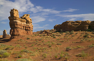
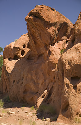
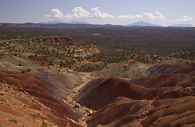
The scenery changes once you reach the Notom-Bullfrog road because you're now in a more desert like environment. Just one of the features above. |
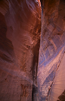
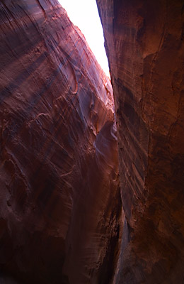
A couple views of a slot canyon I found in Long Canyon.
This was more picturesque than the one I found on the Cottonwood Canyon Road
outside Bryce. This one was only about 200 feet long and 50 feet high. In
places it was only a few feet wide - but it was the right color! Slot canyons are very difficult to photograph because generally, sunlight only gets inside the canyon at certain times of day. If the canyon runs east-west, direct sunlight may only get in the canyon at certain times of the year when the sun is at the right elevation. If the canyon runs north-south, then the sunlight gets in once a day when the sun is directly overhead. This canyon runs NW-SE so not only do you get sunlight when the sun is directly overhead but you get longer periods of the sun coming in at an angle and bouncing around the whole canyon. |
|
|||
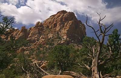
After I'd run the Burr Trail in one direction, West to East, I decided to run it the other direction and take on one of the 4wd trails into one of the canyons. Besides, I was looking for a good place to take a good panorama and had found one on my first run of the Burr Trail but didn't have the right equipment with me. I ended up trying a true 4wd trail called Muley Twist Canyon. Only a few miles long, this trail followed the bed of a part-time stream up Muley Twist Canyon. This was a beautiful run and I did check the weather carefully before I took the run. The whole trail was on a part-time streambed - part-time in that it filled when a storm came over. When I stopped and shut off the Jeep for lunch, the only thing you could hear was the ticking of the engine as it cooled and your own breathing. What I noticed however, is that you are never out of earshot of manmade sounds. You could still hear the occasional jet aircraft 40,000 feet overhead. |
|||
|
|
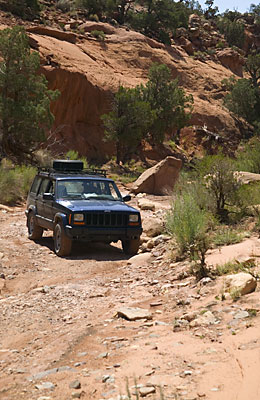
The "roadbed" in the canyon. This is typical, so it's not that bad as long as you take your time and pay attention. |
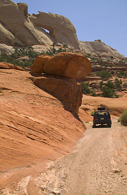
Further up the canyon you go under this overhang and around a corner. There's more room than it looks here. |
Not many people park here - maybe for good reason. Also, a juvenile arch at the top of the photo. |
|
Just west of the Capitol Reef Visitor Center on SR24 is an overlook called Goosenecks. The overlook is some 700 feet over a series of switchbacks cut in the rock by what's called Sulphur Creek. I lucked out. An earlier storm had dumped pretty heavy a mile or so upstream from the "Goosenecks" and I just happened to be there when the storm surge came through. I could hear it coming and it took a while to figure out what it was I was hearing. It finally dawned on me and I moved to a good place where I could see all the water come through and balanced myself on a rock over the gorge. From left to right, the first photo is the "normal" flow of the creek. The second photo is the head of the surge and the third is the peak of the surge. In all, these photos covered a time period of 4 minutes. I printed them off and showed them to the local rangers and they indicated that based on the rock right in the center - the triangular one on the right of the creek - the surge was some 4-6 feet of water. Remember, I'm 700 feet above the water. Now I have a rather graphic appreciation for the capability of a storm surge in one of these small washes or gulches. |
--- Next - Part 16a, a Panorama | ||
| ||
Page 16 | ||
Previous Page | ||
| ||
To The Journal Index | To The Summer 2004 Index | To kenbeard.com |