Ken's Journal
No. 4 - Summer 2004

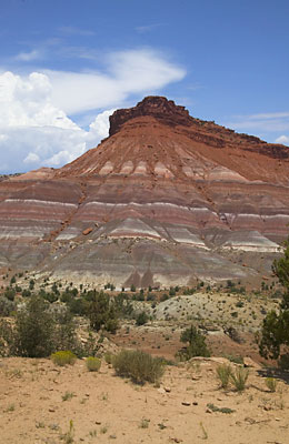
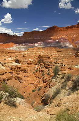
Bryce Canyon, Utah - 07/13 - 07/17/2004
Days 17-21 on the road. Part III.


Continuing our drive down Cottonwood Canyon Road --


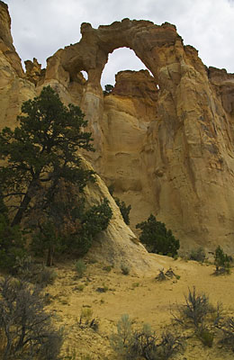
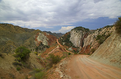
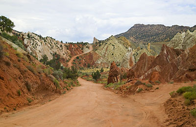
Grosvenor Arch. Cottonwood Canyon Road approaching this area is steep and was partially washed out - just not as bad as the BLM indicated. I'm sure it could get much worse however.


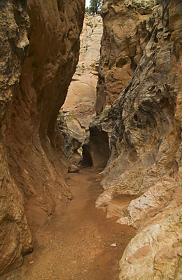
A slot canyon. This particular one was not too colorful and was only 50 or so feet deep and at it's narrowest, perhaps 6 feet wide. It was only a few hundred feet long. I had to jump off a 6 foot ledge to get into it. I was really taking a risk going into this thing. There were clouds gathering for a storm several miles from here but nothing else. A slot can fill with water from a thunderstorm miles away so you have to be really aware of the weather. In the 1990's, eleven hikers were killed in a slot not 30 miles from here.

 
A view down the road - these are the real colors you'll see. All the shades of red, green, yellow and blue you can imagine. I didn't fiddle this in Photoshop!
 

Likewise - these are the actual colors!


Bighorn sheep. It's rare to see these guys this close. There were three of 'em. The third one, the first I saw, jumped out of a gulch and onto the road right in front of me. While I stopped to take pictures of her (looked like she was nursing condition), these two passed behind me. The female got too far away for a good picture, but these guys stuck around for a while. Unfortunately, the lighting was poor - the sun was almost directly overhead. And the sheep are the same color as the rocks!!

  After 50 miles of dirt road I reached US89, traveled west a few miles to another dirt road and then another several miles to what was supposed to be the western movie town. This is it I think. There were only three buildings near the end of this road. Further was supposed to be the remnants of the real town of Parea - abandoned by the Mormons after yearly flooding of the Parea River wiped them out. My charts indicated the real town was across the river so I tried to get there. Continuing on after this 'town' the road dropped to the river bottom. There were several trails cut through the Cottonwoods so with my GPS, I tried to follow them to the other side of the river. No luck. I wandered in a maze of trails through a thicket so thick that sometimes the brush was over the top of the Jeep. I gave up as soon as I found the way back! Maybe next time when I have someone with me, I'll try it again.


Around Parea.
Again, real colors. I believe this is Bentonite - a clay that takes on the color of any minerals present. You can see the layers of ancient sediment clearly!


Also around Parea, but right next to the road. That is a 100 foot gully right off the road - no shoulder here! Pull off at your own risk.
Also real colors!


  Now I had a choice. I could return to Bryce the way I came - another 50 miles of dirt road, or I could continue on US89 to Kanab and eventually back to Bryce on hard surface roads - about 100 miles. While at Parea I had been keeping my eye on a couple thunderstorms circling the area and watched one dump in the area of Cottonwood Canyon Road. I decided on 100 miles of hard surface road. I ran through a couple thunderstorms on the way back and the next day the news was of a car and it's occupants washed off Cottonwood Canyon Road and into a gulch. Both occupants survived, but the car didn't.

Next stop - Capitol Reef National Park.


Page 13

  Previous Page

Next Page


To The Journal Index |  To The Summer 2004 Index | To kenbeard.com