| |
El Morro is also called "Inscription
Rock" because many early travelers left their "graffiti" as they passed
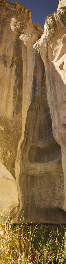
through. So why did so many people pass through? It seems that in this arid
landscape, the rock protects an almost year-round supply of water on the NE
side of the monument. This is not a spring, it is not a creek, stream or
other ground flow. It's a good sized pool of water that is simply sizeable
runoff from the rock in the rainy season!
Here's a panorama of the water
supply. (A vertical panorama - about 200 feet tall at this point!) You can
see the deposits on the rock from where the water runs over the top. The
deposits called desert varnish - more on that later.
|
| |
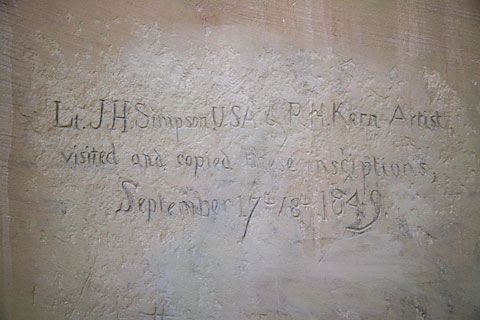 The rock has attracted travelers at
least since 1605 when the first dated inscription was made by Don Juan de
Onate, the first Governor of New Mexico. There are also a number of
petroglyphs from early Anasazi (Pueblo) residents. This is a photo of the first
English inscription made. Lt J H Simpson was an engineer for the Army and R
H Kern was a Philadelphia artist who traveled with the Army documenting
their activities. In 1849, they passed a couple days at the rock recording
all the inscriptions. Lt Simpson reported that not a single English
inscription could be found on the rock. This picture was taken on the shady
side of the rock so needed a bit of enhancement in Photoshop! The rock has attracted travelers at
least since 1605 when the first dated inscription was made by Don Juan de
Onate, the first Governor of New Mexico. There are also a number of
petroglyphs from early Anasazi (Pueblo) residents. This is a photo of the first
English inscription made. Lt J H Simpson was an engineer for the Army and R
H Kern was a Philadelphia artist who traveled with the Army documenting
their activities. In 1849, they passed a couple days at the rock recording
all the inscriptions. Lt Simpson reported that not a single English
inscription could be found on the rock. This picture was taken on the shady
side of the rock so needed a bit of enhancement in Photoshop!
|
| |
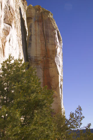
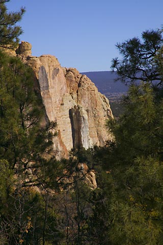
A shot of one of the pillars on the East
side of the rock - note the crack in the center of the pillar. I noticed
some metal pegs on either side of the crack and a cable near the top -- I
was told the Park Service is measuring the crack and it has indeed grown
larger since they started measuring - mother nature at work trying to reduce
everything to rubble. |
| |
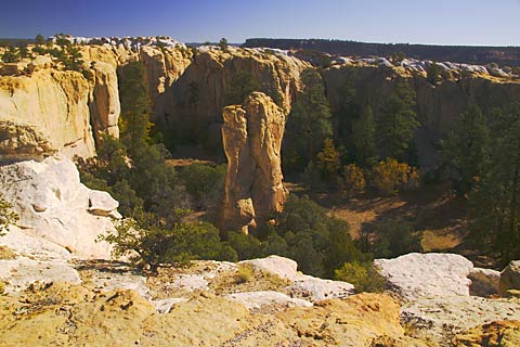
Across the top of the rock -- This is
a large box canyon with a pillar in the middle hiding inside El Morro.
|
| |

One of the vistas from the top.
|
| |
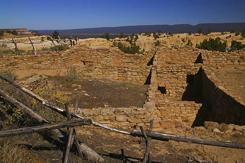
The Anasazi ruin. |
| |
One of my favorite shots. Taken as
I'm coming down off the rock -- In the center is the same pillar with the
crack shown above. |
| |
I finished up at El Morro by about
11:30 am and got on the road again to Canyon de Chelly. I arrived some four
hours later and set up camp in a Fee-Free National Parks Campground --
Fee-Free because it's little more than a parking spot in a picnic area. My
intention was to spend three days and four nights. |
| |
"The tragedy of life is not that it
ends so soon, but that we wait so long to begin it." -- W. M. Lewis
|
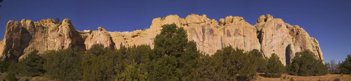
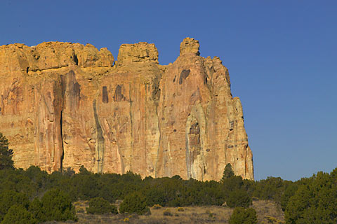 El
Morro is a National Monument. El Morro, "the headland," is simply the point
of a large, sandstone mesa. This rock has been shot many times, from many
angles. Here's one of the classic shots. Sure looks familiar doesn't it?
This rock has been a background in a lot of commercial advertising. There's a 2 mile hike around and up to the top of the rock. At the top there are
some Anasazi ruins, a view over a box canyon and a pretty good vista of the
whole countryside. The claimed elevation gain is 200 feet, but I measured
300 from my RV in the parking lot to the top.
El
Morro is a National Monument. El Morro, "the headland," is simply the point
of a large, sandstone mesa. This rock has been shot many times, from many
angles. Here's one of the classic shots. Sure looks familiar doesn't it?
This rock has been a background in a lot of commercial advertising. There's a 2 mile hike around and up to the top of the rock. At the top there are
some Anasazi ruins, a view over a box canyon and a pretty good vista of the
whole countryside. The claimed elevation gain is 200 feet, but I measured
300 from my RV in the parking lot to the top.