Ken's Journal
No. 4 - Summer 2004

Grand Teton National Park,  - 08/07 - 08/10/2004
Days 42-45 on the road. Part II.


Teton Maps.

Each of the maps below covers an area of about 660 square miles, or 22 miles north to south by 30 miles east to west.

For low resolution, low bandwidth connections: Teton North (217 kb), Teton South (230 kb)

For high resolution, high bandwidth connections: Teton North (835 kb), Teton South (883 kb)

All of the images I've taken in Teton were taken on the Teton North maps.


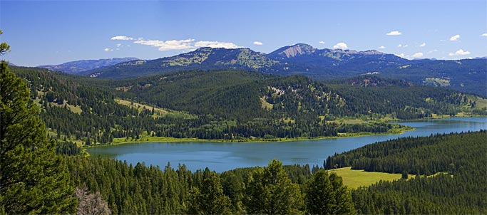
One of the views from a short hike up the Two Ocean Lake Trail to Grand View Point - elevation 7520 feet. The tallest appearing mountain on the right is Mt Moran. To the left is Mt St John, Teewinot, Grand Teton, Middle and South Teton.

The hike to Grand View Point is only ¾ of a mile one way, with an elevation gain of 600 feet. The trailhead is best reached with a high clearance vehicle. From the trailhead for cars, the hike is 1½ miles one way.
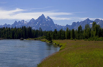
 
Right next to the Snake River looking southwest at Grand Teton, the tallest mountain in the Teton range at 13,770 feet.

This was my own hike - no trail. I followed a high clearance road from the main road through Teton to the Snake River. This unimproved road is used to access the river for fishing on foot. I hiked a mile in each direction up and down the river and saw few people. I saw no one fishing but maybe four kayaks went by in the couple hours I was there.

 
Right next to Jackson Lake looking at Mt Moran. You can see the lake is down quite a bit. These rocks would normally be under a few feet of water. The lake is so far down the Marina is closed. Water from Jackson Lake is used to maintain water levels of the Snake River and further down the river, for irrigation. The summer water level in Jackson Lake depends heavily on the previous winter snowfall - and there have been a couple years of light snowfall.
 
Mt Moran again - this time reflected in Jackson Lake. This picture was taken from the dam at the bottom of Jackson Lake.

I'm not sure what mountain this is or where in the park the picture was taken. It's just a nice composition.
 
 
This is Two Ocean Lake from Grand View Point. Early travelers thought the lake drained into two different oceans - although it's close to the continental divide, it does not. There are a couple ways to hike around the lake. You can continue around the lake from this point and return to this point for a round trip hike of 9 miles. You'll climb the 600 feet to Grand View Point both at the beginning of the trail and again at the end. Another hike on the same trail around the lake starts at a trailhead at the far right in this picture but bypasses Grand View Point. The hike around the lake from that trailhead is pretty level and only 6½ miles long - but you miss this great view of the whole lake! In any case, this is a lightly used trail so the likelihood of meeting up with a bear is pretty good - a ranger told me a grizzly had been seen feeding on the far shore within the past week.
 
  I was in Grand Teton for three nights, two full days. I visited only a small part of the park. If you are on a limited schedule, you can see most of the park from the improved roads in the park. You won't really experience the park unless you get out of your car and hike a few of the trails, take a couple trail rides, a guided tour or two and perhaps a float down the Snake. Next time, I'll give myself a few more days.

I came into the park from the east on US26. That put me in the northern half of the park from the start and I never got south of Jenny Lake. My advice is that if you are on a limited schedule, come into the park from the south (or north if coming from Yellowstone) so you can see the whole park.

Next, Yellowstone.


Page 31

  Previous Page

Next Page


To The Journal Index |  To The Summer 2004 Index | To kenbeard.com