Ken's Journal
No. 4 - Summer 2004
Capitol Reef National Park, Torrey, Utah - 07/17 - 07/21/2004
Days 21-25 on the road. Part IV.

|
Ken's Journal Capitol Reef National Park, Torrey, Utah - 07/17 - 07/21/2004 |
||
|
|
||
 |
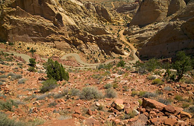
This is where the Burr Trail meets the Notom-Bullfrog Road. The Burr Trail is several hundred feet higher in elevation. This series of switchbacks is seven levels and each is about a 10% grade - no guard rails, no shoulder, no sweat. | |
|
An ancient sand dune on the Burr Trail. - Frozen in time - |
|
 |
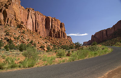
Coming out of Long Canyon on the Burr Trail. |
|
|
 An other-worldly view of the same dune. |
|
My friend the front-end loader, cleaning out the washes on the
Notom-Bullfrog Road. I talked to him and he indicated that the worst one, on
the Burr Trail just before it meets the Notom-Bullfrog Road, had three feet
of mud in it! |
|
|
|
|
 |
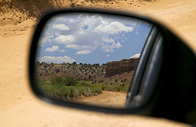
When you're out looking for picturesque scenery, check your rear-view mirror occasionally. You'll sometimes see a nice scene you missed when looking at it the in the other direction. When hiking, do the same - look up, behind you, all around. So what does a camera focus on when looking in a mirror? The same thing your eyes do - the object, not the image in the mirror. Otherwise, the frame of the mirror would have been in focus too. |
| This is the view outside the door of my motorhome in the RV park. The formations on the side of that mesa are called "mummy" formations. Erosion has formed columns that look like carefully wrapped mummies! |
 |
|
Capitol Reef is largely undeveloped
for the tourist. There are only some 32
miles of paved road in the park, including
about 20 miles of SR24, and
only a few miles of well graded and maintained dirt road suitable for the
average street car. Many people brave the Notom-Bullfrog and Burr Trail
Roads, parts of which are in Capitol Reef
- but most do so in a SUV
of some sort. If you've a suitable vehicle and don't mind a few dings and
scratches, you've a lot more territory available to you
by trying some of the real off-road trails.
During my visit, a large part of the park was closed to everything. North of SR24 is what's called Cathedral Valley - about a third of the area of Capitol Reef. This valley is normally only accessible to 2wd high clearance vehicles, 4wd preferable, via a 50 mile loop road. The storms had been so bad, this whole area was impassable to anything. One end of the loop is accessible only by a ford across the Fremont River, now impossible because of the high water levels. The other end of the loop is accessible from Caineville, but uses a couple miles of a wash, now full of a couple feet of mud and water. If you can get past those obstacles, then you're faced with the wet bentonite roadbed - slippery as ice when wet. The few miles of Capitol Reef accessible to everyone are worth the trip. This is a park where, at the bottom of the canyons, you are part of the vista, not just looking at it! Next - Moab UT, Arches NP, Canyonlands NP | ||
|
|
||
|
Page 17 |
||
| Previous Page | ||
|
|
||
|
To The Journal Index | To The Summer 2004 Index | To kenbeard.com |
||