Looking north to south through the part of the canyon called Fairyland. You can see the thunderstorms forming for the afternoon onslaught.
|
Ken's Journal Bryce Canyon, Utah - 07/13 - 07/17/2004 |
||||||
|
|
||||||
|
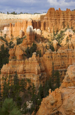
Bryce Canyon is one of those unique places where geological forces over the
eons have transformed the landscape into a fantastically bizarre sight of
thousands of red and white spires and pinnacles locally called Hoodoos. This
is one of the few places in the west that archeologists have not found
evidence of ancient human populations. Perhaps because of the hoodoos, the
ancients considered the area possessed with spirits.
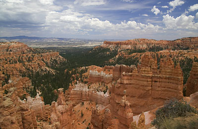
Bryce Canyon is the northernmost step of what is called the Grand Staircase. During the Cretaceous Period from about 144 Million Years Ago (mya) to about 65 mya, a vast inland sea extended northward from the present day Gulf of Mexico to cover most of the mid-west and west. As this sea repeatedly receded and then re-invaded the region, vast areas of sediment thousands of feet were left on the land. These are the lowest, oldest, gray-brown rocks at Bryce Canyon. Then, between 65 mya and 40 mya during the Tertiary Period, rivers and streams from the surrounding highlands deposited iron-rich, lime type sediments in a vast freshwater lake system. These sediments became the reddish-pink rocks from which the Hoodoos have been carved by erosion. Now the earth became a little restless and about 10 mya, the earth pulled apart, moving and tilting huge blocks of the earth's mantle. Now, layers that were once connected became displaced vertically thousands of feet. So older layers of sediment now lay side-by-side with much younger layers and erosion began to take it's toll. Because the rocks are different densities, they erode at different rates and you now have a staircase effect. If you were to slice the earth north-to-south (more-or-less) through Utah and Arizona and look at the side of the slice, you'd see several giant steps. The pink cliffs of Bryce are the top step, gray cliffs are next followed by white cliffs, vermillion cliffs and finally chocolate cliffs before reaching the north rim of the Grand Canyon. Zion Canyon runs north-to-south, bisecting the gray and white cliffs. The weather that caused all this erosion, is still at it. Every day I was at Bryce, afternoon thundershowers would shot-gun the area. Bryce got hit lightly once, most of the activity was in the valleys to the east of us. Bryce is laid out ideal for the hit-and-run tourist. The 18-mile-long
park road takes you to all of the overlooks and you can reach most from the
road without walking more than a quarter mile. If you don't do trails or
ride horses, you can see Bryce in less than a day. |
||||||
|
|
|
|
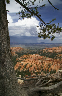
| From a little further down the canyon rim and a bit later in the day, here's a picture of a whole thunderstorm doing it's thing in a nearby valley! | 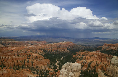 |
 Another shot of the same storm. |
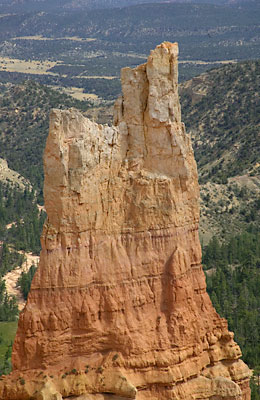 One of the pinnacles. This one has a name but I sure didn't keep notes on this one. |
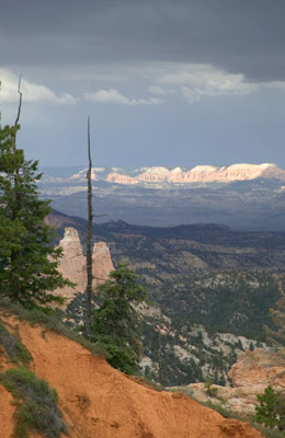 A view from under a thunderstorm to a set of brightly lit cliffs in the distance. I'm not sure, but I think they're in the same series as Bryce - they're pink. |
|
|
|
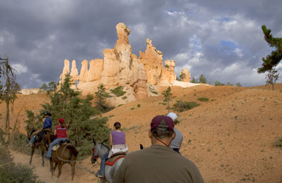
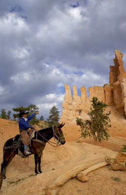
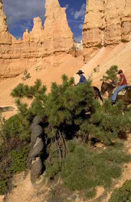
| My fearless stead. They told me his name was Goose. I believe his real name was Stumbles - he had this nasty habit of tripping over his feet occasionally. Usually this was right next to a 600 foot drop-off. He also had another nasty habit of turning towards the drop-off and putting his front feet right on the edge every time we stopped. That meant I could look down over his shoulders and see nothing but air. All of these mules have another nasty habit of walking as close to the edge as possible. So I could look at my foot in the stirrup and see the same thing - nothing but air! If you fear heights, don't do this ride. | 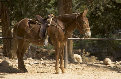 |
|
|
|
||
 As usual, this tree has a cowboy name. No, not naked lady tree, but Twisted Tree! Go figure. |
|||
More to follow - stand by for Part II. |
||
Page 11 |
||
| Previous Page | ||
To The Journal Index | To The Summer 2004 Index | To kenbeard.com |
||