A travel day - Holbrook AZ to Globe AZ via Show Low AZ - 150 miles today. That's not a great distance, but the road was really interesting!!
The route I took was south on AZ 77 into Show Low (a "big" town as it has a Wal-Mart) and then onto AZ 60 into Globe. That took me through the Salt River Canyon and an elevation change of 2400 feet down and then 2400 feet up in less than 20 miles! This is a major north-south route in AZ so it sees a lot of heavy traffic. It's wide, smooth and has a lot of turnouts - in case your brakes start feeling a little funny.
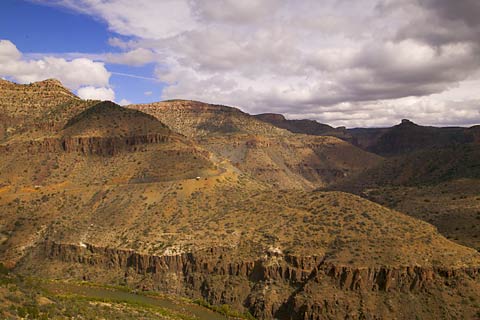
This is a shot looking north - I've already been down the road you see and I'm on the upside of the canyon. As a reference, that little white dot you see a little left of center in this picture is a pick-up truck towing a trailer up the hill.
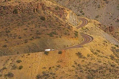
What? You can't make that one out? Here's a full size of that piece of the picture. Does this camera have great resolution or what?
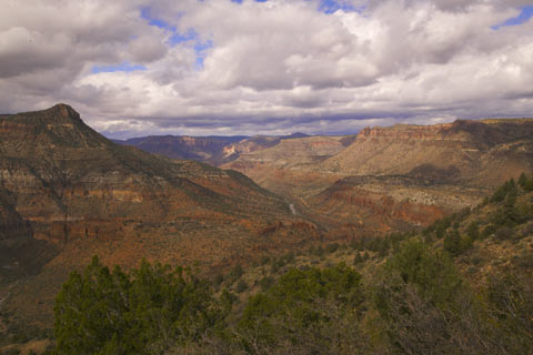
After making it to the top, you have a dramatic view of the Salt River Canyon -- here looking up-river.
I started early for the Apache Trail -- This is AZ 88 starting in Apache Junction (20 miles east of Phoenix AZ) and running 42 miles to F D Roosevelt Lake. Originally constructed so supplies could be hauled to the site of the Roosevelt Dam, it follows the route of a trail used by the ancient Indians. From Apache Junction, about 20 miles of the trail is paved. The remainder is un-paved.
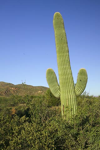
From the Casino on AZ 60, I head back west through Globe and make a right on AZ 188 to head north. On the way, I find my first real indication I'm in the Great American West - my first Saguaro Cactus! After three weeks in the west, and this is the first one I've seen. Now I know I'm in the West! . . . Howdy Pardner!
 A
mile or two before turning onto the Apache Trail, I find the Tonto National
Monument, a pair of ancient Salado dwellings high on hillside. One, the
lower cliff dwelling has been "stabilized" by the park service and is easily
accessible by the public. The round trip hike of about a mile takes close to
an hour. The upper cliff dwelling is only accessible on a weekly hike
accompanied by a Ranger as a guide. This is about a four hour round trip.
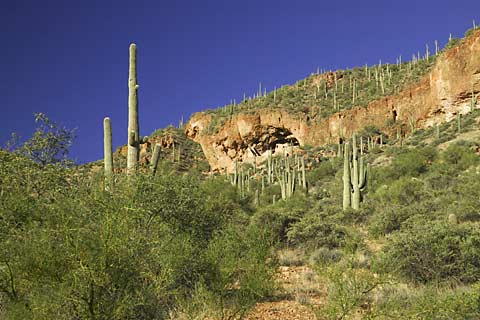
This shot of the lower cliff dwelling is from the parking lot - the upper
cliff dwelling is not visible from here.
A
mile or two before turning onto the Apache Trail, I find the Tonto National
Monument, a pair of ancient Salado dwellings high on hillside. One, the
lower cliff dwelling has been "stabilized" by the park service and is easily
accessible by the public. The round trip hike of about a mile takes close to
an hour. The upper cliff dwelling is only accessible on a weekly hike
accompanied by a Ranger as a guide. This is about a four hour round trip.
This shot of the lower cliff dwelling is from the parking lot - the upper
cliff dwelling is not visible from here. 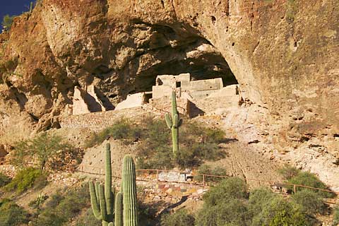
A closer shot. You can see the railing next to the path built by the park service. In fact, the path to the top is paved.
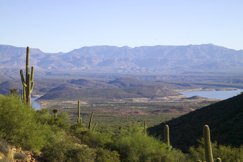
The view from the dwelling. Not too bad at all! The water is F D Roosevelt Lake. The lake was created by the construction of the F D Roosevelt Dam for the purpose of supplying Phoenix and the salt River Valley with dependable irrigation and flood control.
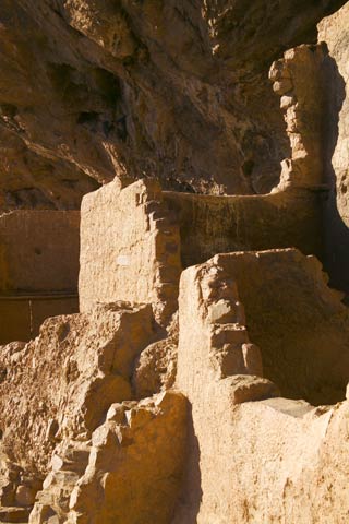
A close-up of the front of the dwelling.