Ken's Journal Anchorage to Tok and on to Fairbanks and the Far North |
I'm a traveler. I enjoy the getting there as much as the being there. This page in my Journal is about the getting there - getting to Fairbanks from Anchorage. From Anchorage, I had to go through Tok to pick up my Jeep - which had been in the shop for over a week getting a new transfer case and front drive shaft. So this would be a round-about way to get to Fairbanks, my real destination. |
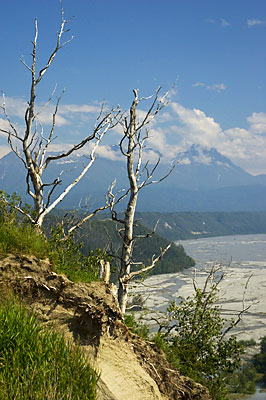
This was taken at an overlook on the Glenn Highway somewhat east of Anchorage. The river below is the Matanuska and the mountains in the distance are part of the Chugach Range. |
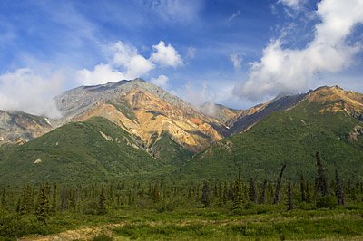
Looking north from another overlook, this is Sheep Mountain, part of the Talkeetna Range. The orange color is gypsum stained by iron oxide - rust. The gypsum is the result of hydrogen sulfide and water intruding on limestone, altering it's characteristics - the result is gypsum - the same stuff in your wallboard. The hydrogen sulfide and water intrusion is most likely the result of volcanic action - this area is part of the "ring-of-fire" surrounding the Pacific with hundreds of still active volcanoes. This particular area is where the Pacific Plate is subducting under the North American Plate. Just a few miles from here - west of Valdez - the strongest earthquake ever to hit North America struck in 1964 - a 9.2 magnitude. Sheep Mountain is aptly named too. The gypsum deposits attract Dall Sheep who visit the deposits for the calcium and magnesium to supplement their diet. |
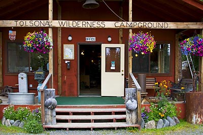
A bit further down the road, I decide it's time to stop for the night. My reference lists a Tolsona Wilderness Campground that sounds promising. I turn off the Glenn Highway on a small gravel road marked with the campground sign. After a few hundred yards, the road narrows and brush is hitting both sides of the motorhome! Yikes! Am I on the right road? Am I going to be able to get out of here? After about a half mile, I can see other campers in the woods on either side and shortly thereafter come to a small wooden bridge - barely wide enough to fit the motorhome and looking just a little better than rickety! On the other side, I find the office for the campground. It's obvious right off they like flowers and inside I find a couple rooms of antique tools and equipment for sale! |
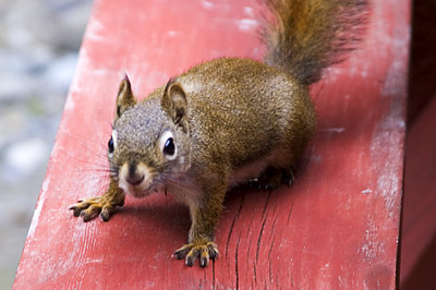
I picked a campsite beside a stream, moved in and set up. Here's the welcoming committee looking for a handout. |
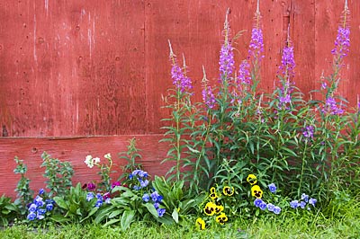
More flowers. |
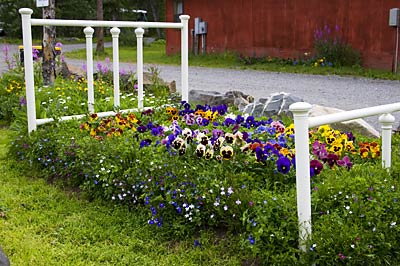
A flowerbed of course. |
I left the next morning for Tok. Before setting up in the campground there, I checked in at the shop where the Jeep was being repaired. I'd have to wait a day as they were waiting for one more part - the speed sensor. Seems that the wrong one was sent the first time. Well, as luck would have it, the wrong one was sent the second time as well so we just plugged in the original, damaged sensor and I was on my way - without a speedometer or cruise-control and a permanent check-engine light. I did have an OBDII tester with me so I could check the engine error codes (which generate the check-engine light) and clear them if I wanted. I had two error codes, one was because of the lack of a speed signal and the second was because of a faulty pre-heater on the secondary Oxygen Sensor. I checked them and reset them occasionally just to make sure there was nothing else going on. I figured I'd try to get the correct speed sensor at the Chrysler Dealer in Fairbanks and forget about the Oxygen Sensor until I got home - it was an intermittent fault anyhow. |
|
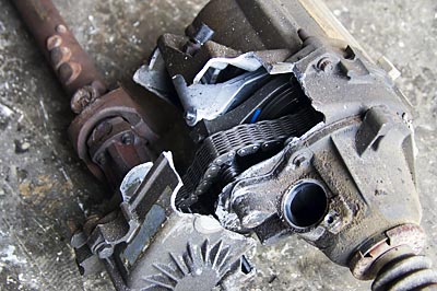
Old Transfer Case - Broke. |
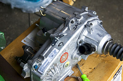
New Transfer Case - Shiny bright. |
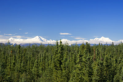
I'd been in Alaska six weeks now and still hadn't seen Denali (Mt. McKinley). It seems that only one in three visitors to Alaska ever get to see the mountain, the highest in North America, because of the persistent cloud cover. Well, on the way to Fairbanks, about 10 miles south of Delta Junction, I looked to my left and what did I see? The sky was clear all the way to Denali! The picture above was taken at about 70mm and appears as you would see it with the naked eye. What you see is Mt McKinley (Denali) on the right with Mt Foracker on the left. From where this picture was taken, Denali is some 170 miles away!! Yikes! This is like being able to see the buildings in New York City while you're standing in the middle of Baltimore, Maryland! |
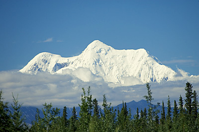
Here's Denali at 400mm. From right to left, the peaks are the East Buttress, Mt McKinley in the middle and the South Buttress on the left. Just to give you a sense of scale - note the mountain range below McKinley in the mid-ground - right behind the spruce trees slightly to the right of center. My guess is that's Mt Hayes, only half the distance from me to McKinley. This view lasted 30 minutes before the clouds closed in again. (And yes, I use the names Denali and McKinley interchangeably to refer to the mountain - historically, the name is Denali, politically, the name is McKinley. The state of Alaska has wanted to change the name to Denali for years, but are blocked by the machinations of a Senator from Ohio, which is the home state of President McKinley.) |
| I arrived in Fairbanks, set up the motorhome in a nice campground and headed off to the Chrysler Dealer. We looked up the part I needed, looked at a picture of the actual part to make sure I was getting the right thing, and ordered it. Seems it had to come up from Portland, OR - $50 for the part and I paid a $7 premium to get it in under a week. I received it three days later, installed it and had my speedometer and cruise control back again. I still have the intermittent Oxygen Sensor problem however. |
Next - Things to do in and around Fairbanks. |
Page 20 |
