Ken's Journal On the Road. Dawson City, Yukon To Anchorage, AK |
Well, the trip from Dawson City, Yukon back to Anchorage, AK was reasonably uneventful. We made a straight shot from Dawson City (START on map below) to Tok with a stop in Chicken for lunch. We also stocked up on Chicken Sue's Blueberry Muffins and giant Oatmeal Raisin Cookies (Grain and Fruit at the same time - talk about healthy!). At Tok we checked in on the Jeep and found the parts were on their way. Since we had a couple days before we had to get Lesley on her plane, we wandered some of Alaska's back roads. We made a short trip to Delta Junction (NE on RT 2, the Alaska Highway) and took in the Pipeline crossing the Tanana River and Rika's Roadhouse where we had lunch. After lunch we headed south on the Richardson Highway (RT 4) for Paxson, the eastern terminus of the Denali Highway (RT 8). Originally, this was the only route into Denali National Park. The George Parks highway (RT 3) connecting Anchorage and Fairbanks directly with the Park wasn't built until the 60s. From Paxson it's 135 miles west to Cantwell, the end of the Denali Highway - only 30 miles of that is paved, the rest is unpaved. Services, such as they are, are 40 miles apart. We stopped on the Denali about 10 miles west of Paxson in a wide spot in the road for the night - you can do this in Alaska - it you can get off the road, there are no signs to the contrary and it's not private property, you can camp where you wish. So we set up in a scenic overlook - in the rain - so there was little scenic about it. The green line is our route - a little over 700 miles. |
|
As you can see from a map of central Alaska, there is little to the roads here. With the exception of a 400 mile stretch of the Dawson Highway from Livengood (Top of the map - Rt 11) to Deadhorse and Prudhoe Bay, this shows all the roads in the state. The dashed line to the right is the border with Canada. The Alaska Highway is RT 2 in Alaska and RT 1 in Canada. Regardless of how you drive into the state, the Alaska Highway or the Top-of-the-World Highway, you have to go through Tok, which serves as the gateway to AK for motorists. Tok is set up for the traveler - RV Parks are abundant as well as RV repair shops. There's one grocery store, two liquor stores, a number of gas stations and an Alaska Visitor's Center. Basically, nothing much to look at. 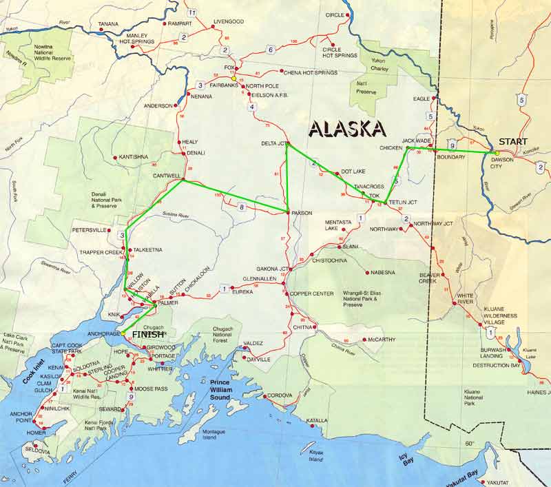
|
After a restful and quiet night by the road (absolutely no traffic) the rain had ended and we tackled the Denali Highway with an early start. This highway turned out to be the worst dirt road we'd been on - worse than the Top-of-the-World from Dawson, worse than the McCarthy road to Kennecott. There was little joy in dodging 100 miles of potholes and struggling for control on the washboard. This is the Tangle Lakes ARchaeological District and has more than 600 archaeological sites with artifacts from pit-houses to hand made stone tools. Carbon dating puts some of the artifacts at 10,000 years old. About half-way across we stopped for a hike out onto the tundra - the Maclaren Summit Trail. This was supposed to be a 3 Mile one-way hike, but apparently we unintentionally found another mile or so. Once you get out in the tundra away from the road, this place is, well, not exactly desolate, but damn close! This is the second highest highway summit in Alaska at 4000 feet. |
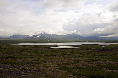
This is a view of some of the many small lakes in the area looking toward the Amphitheater Mountains. As you can see, the weather is a little iffy. |
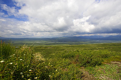
Looking to the west out over the maclaren River Valley. The maclaren River flows from the Maclaren Glacier south to the Susitna River and then into the Cook Inlet just west of Anchorage. The clouds are the real photo here. |
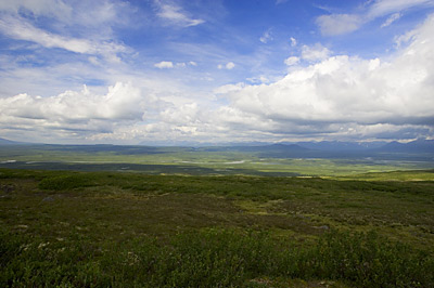
More clouds, to the SouthEast this time. You can still see the Maclaren River in the valley.
|
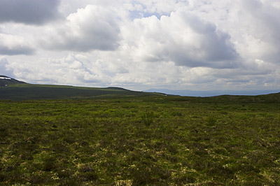
Looking back toward the RV - it's right on the horizon in the center. At this distance, about 2-3 miles, it's about two pixels big! |
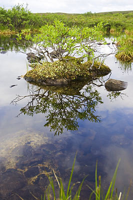
A small island in the middle of one of the permafrost potholes. These potholes are created when an ice lens in the permafrost below melts, forming a basin that catches and traps the meager water that falls here.
|
Vegetation at this elevation is low-growing alpine tundra, lichens and mosses. Most of the vegetation is knee-level or lower. It's still bear country though. You'd think that with the low vegetation you could see 'em a long way off - but with the rolling hills and valleys, you still have to be alert. |
Just down the road from the hike is the Maclaren River and the Maclaren River Lodge - this is in the middle of nowhere but here is a lodge and restaurant - power is by generator, just as in Chicken. Amazingly, we find this is a stop for tour busses that travel the Denali Highway - as we arrived, one Princess Line bus was boarding as another was just unloading! The amazing part was finding that large tour busses use the Denali Highway - 100 miles of brutal dirt and gravel! We decided to skip lunch at the lodge as the second bus had just disgorged 40 hungry passengers in front of us. So we moved on in front of both tour busses. A little further down the road, perhaps 40 miles - about 90 minutes on this road - we found another restaurant, the Gracious House. We parked, found a seat at the bar and ordered lunch. It seems that at least one of the tour busses we saw at the Maclaren River Lodge was going to arrive here shortly and let loose all 40 passengers for dessert! Good thing we got here when we did - the cook just finished our orders and the bus arrived! It seems this place is famous for blueberry cobbler!! This seems to be common all over Alaska - we found it at Chicken and we found it here, on the Denali Highway. Tour busses stop at small, but apparently well-know off-the-beaten-path restaurants for their passengers. Were it not for these stops 3-4 times a week, these places would soon be out of business! |
Next - Dawson City to Anchorage, Part II. |
Page 18 |
